

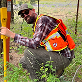
Field Work
-
Record of Surveys
-
Boundary Line Adjustments
-
ALTA/NSPS Surveys
-
Topographic Mapping
-
Lot Surveys
-
As-Built Surveys
-
Utility Locations
Floodplain
-
Orthographic Mosaic
-
Drone
-
Photogrammetry Missions
-
Aerial & Ground Control & Proofing
-
Lidar Mapping
-
Point Cloud Generation
-
Feature Extraction from Drone Data for Design and As-Built Mapping
-
FEMA Elevation Certificates
-
LOMA Projects
-
LOMR Projects
-
On-Site Benchmarks
-
Certificate of Exemption Applications & Exhibits
-
Short Plat/Minor Subdivisions
-
Preliminary Plat Subdivisions
-
Final Plat for Subdivisions
-
Binding Site Plans
-
Plat Alterations
Surveys

Mapping

-
Property Corner Locates
-
Resetting Property Corners
-
House Staking
-
Easement Location Staking
-
Property Line Staking
-
Foundation Staking


PLS Services
-
Legal Descriptions
-
Easement Exhibits
-
Easement Description
-
Certificates of Exemption
-
Project Consultation

Subdivisions

Have a question or want advice on the direction of your project?
Give us a call or send an email to the address below.
(406) 544-6718
PO Box 1254
Mead, WA 99021